Annapurna Circuit TrekkingAnnapurna Circuit Trekking

Annapurna Circuit Trekking

6 REVIEWS
Highlights
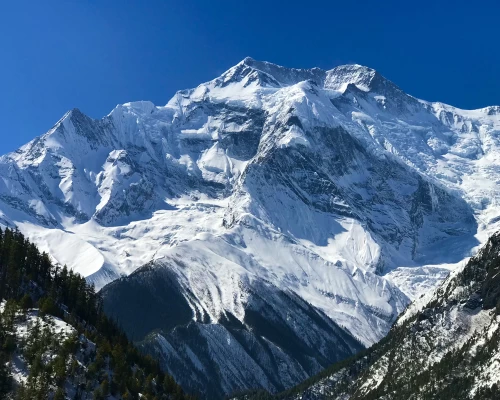
  • An unforgettable journey across the circling trails of the world’s tenth-highest peak, Mt. Annapurna (8,091 meters)
  • Fascinating culture, traditions, and lifestyle of the diverse ethnic groups residing in the region: Magar, Gurung, Thakali, and Tamang
  • Most stunning vistas of the Himalayan peaks like Annapurna I, II, IV, Annapurna South, Nilgiri, Dhaulagiri, Lamjung Himal, Machhapuchhre and other surrounding peaks
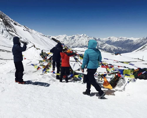
  • Exhilarating Himalayan pass, Thorong La Pass (5,416 meters)
  • Deepest gorge in the world, Kali Gandaki Gorge
  • Muktinath Temple, one of the world’s highest temples with 108 water sprouts
  • Natural hot spring at Tatopani, which has skin healing properties
  • Hike to the popular viewpoint of the lower Annapurna region, Poon Hill (3,210 meters) for epic Himalayan panoramic views
  • Traversing across the rich biodiversity of Annapurna Conservation Area (7,629 km2/ 2,946 sq mi), the largest conserved area in Nepal

Journey around the massive Annapurna Himalayas and cross the high Thorang-La pass

Annapurna Circuit Trek, a fascinating journey that navigates the basin of the tenth highest peak standing on earth, Mt. Annapurna (8,091 meters), is something of a life-long experience. This popular trekking adventure in the second mainstream trekking region of Nepal has it all: the incredible cultural experience where you walk across the traditional settlements of Gurung, Magar, Thakali, and Tamang ethnic groups is as diverse as it can be. Similarly, trekking through the lush landscapes that take you to several climatic zones, an enriching experience exploring the rich biodiversity of Annapurna Conservation Area, charming waterfalls/rivers, and the breathtaking vistas of the central Himalayas are other memorable aspects of this classical adventure.

Besides exploring the mainstream circuit trekking route of Annapurna, our itinerary plan also takes to the most popular viewpoint in the lower region, Poon Hill (3,210 meters. From this high viewpoint, the incredible 360° panoramic views of the mountain range like Annapurna I, Annapurna South, Annapurna III, Dhampus Peak, Hiunchuli, Machhapuchhre and Dhaulagiri. Annapurna Circuit Trek is perfect for trekkers who are looking for a dynamic blend of both cultural and natural experiences in the Himalayan region.

This circuit trekking route offers the most epic Himalayan trekking experience, traversing across the rugged and remote landscapes of the mountain, walking over the pass, and serene meadows. Furthermore, you will also have the chance to experience the unique culture and traditions, religious aspects, and warm hospitality of the beautiful settlements along the route. As this trekking adventure doesn’t lack on any experience and sums up an ideal Himalayan journey, this is among the most beloved trekking routes in the world.

You may also like:

Itinerary

Kathmandu Altitude: 1,400 meters/ 4,593 feet

On your arrival at the Tribhuvan International Airport (TIA), our staff will receive you at the airport and drive you to your star hotel situated in the core of Kathmandu. Depending on the hour of your arrival, after getting some rest to get over the jet lag, you can do some sightseeing activities near your hotel.

You can also visit our office in Chabahil, Kathmandu, for an overall briefing about the exciting adventure up ahead. In the evening, we will also host a welcome dinner at a traditional Nepali restaurant and you will be able to meet the rest of the staff and group members.

    Kathmandu Altitude: 1,400 meters/ 4,593 feet

    Before taking up the trail of this second mainstream trekking destination, you will spend the second day of the Annapurna Circuit Trek itinerary plan exploring the cultural highlights of this capital valley. On this day, you will do some sightseeing at the world heritage sites in the capital to learn more about the religious aspects and incredible history of this Hindu country.

      Kathmandu Altitude: 1,400 meters/ 4,593 feet

      Jagat Altitude: 1,430 meters/ 4,691 feet

      Elevation Gain: 30 meters/ 98.4 feet

      You will start your driving adventure on this day after a hearty breakfast. After boarding a private jeep or a comfortable tourist bus, you will head toward the Besisahar in the Lamjung district. You will drive past the scenic landscapes filled with nature’s wonders and cascading waterfalls/rivers during your drive. After passing several rural settlements along the way and enjoying the first epic views of Manaslu, Annapurna, and Lamjung Himal, you will finally reach your resting destination.

      Drive Duration: 7 hours

      Drive Distance: 185 km

        Jagat Altitude: 1,430 meters/ 4,691 feet

        Dharapani Altitude: 1,860 meters/ 6.102 feet

        Elevation Gain: 430 meters/ 1,410 feet

        Your trekking adventure on the alluring Himalayan trails will finally begin on this day. After enjoying a warm breakfast, you will leave Jagat behind, following the enchanting trails alongside the Marsyangdi River. Following the classical trails of the Annapurna circuit, you will first reach the Chamje Village, and about an hour of trekking from here takes you to the Tal Village. Tal is the starting point of the Manang district and is situated at the bank of the Marsyangdi River.

        Then, trekking past the terraced farms of rice, barley, and potato up ahead, you will push for the Kodo Village. This is one of the largest villages in the Manang district; moving forward with the gradually inclining trail, you will cross a suspension bridge to reach Kani and finally climb to Dharapani.

        Trek Duration: 6 hours

        Trek Distance: 15 km

          Dharapani Altitude: 1,860 meters/ 6,102 feet

          Chame Altitude: 2,720 meters/ 8,923 feet

          Elevation Gain: 860 meters/ 2,821 feet

          Leaving Dharapni behind, you will enter the lush forested trail of pine, oak, fir, and maple trees on the bankside of the Marsyangdi River. You will move along charming trails across the forests until you reach Bagarchhap, which is a Tibetan culture-influenced settlement with unique architecture. Moving further ahead in your trekking trail will then take you to the apple orchards of Dhanaqi Village, which offers rewarding views of the Lamjung Himal, Annapurna II and Annapurna IV.

          You will continue trekking alongside the bank of the Marsyangdi River and pass the traditional settlements of Ratamanang Village and Koto Village before arriving at Chame. Chame is the headquarters of Manang district, and you will rest here tonight, relishing the amicable Himalayan ambiance.

          Trek Duration: 5 hours

          Trek Distance: 15.5 km

            Chame Altitude: 2,720 meters/ 8,923 feet

            Pisang Altitude: 3,190 meters/ 10,465 feet

            Elevation Gain: 470 meters/ 1,541 feet

            On this day’s remarkable trekking adventure, after breakfast, you will follow the scenic trails on the northern side of the Marsyangdi River. Trekking past the pine and rhododendron forest, you will walk across small settlements on the hamlets before reaching the Bratang Village. Continuing alongside the Marsyangdi River, you will make your ascend toward the Dukure Pokhari where you will take a lunch break.

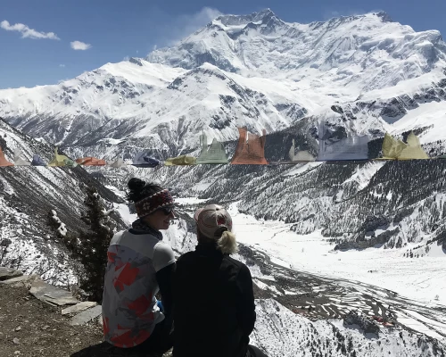
            You will then trek on the flat valley trail near the Annapurna II and Annapurna IV glaciers, enjoying the stunning views of the Annapurna massif on the south side and Pisang Peak to the northeastern side. During the last stretch of todays’s trek, you will make your descent to the basin of Manang Valley to reach the Pisang Village.

            Trek Duration: 5 hours

            Trek Distance: 13.2 km

              Pisang Altitude: 3,190 meters/ 10,465 feet

              Manang Altitude: 3,540 meters/ 11,614 feet

              Elevation Gain: 350 meters/ 1,148 feet

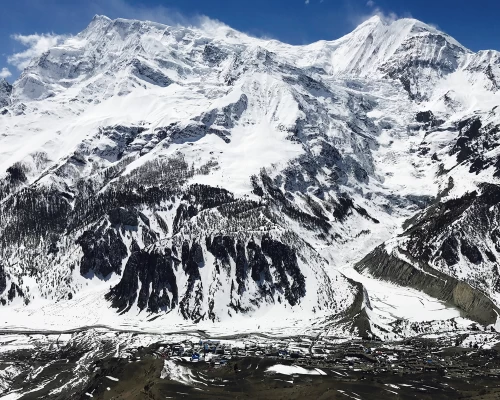
              This day trekking adventure will take you to Manang across the Gheru upper trail from Pisang. The enchanting views of the pristine Himalayan peaks, like Annapurna II, Annapurna III, Annapurna IV, Pisng Peak, Gangapurna, and Tilicho Peak, will accompany your trekking journey on this day. Enjoying the chill and crisp atmosphere from the top of the hill, you wil make your descent to the Kondge Village.

              Before reaching Manag, you will also pass the Braga Monastery. This Buddhist monastery is popular for its exceptional artwork, ancient scriptures, and religious artifacts; this monastery has great significance in Manang and is believed to be about 600 years old.

              Trek Duration: 4 hours

              Trek Distance: 17 km

                Manang Altitude: 3,540 meters/ 11,614 feet

                You have ascended to a significant altitude in your Annapurna Circuit Trek; thus, it is important for you to adapt to the new altitude before pushing even further. Today, you will take your time to explore the incredible highlights of this Himalayan village. You can do a short morning hike to Gangapurna Glacier and Manag Glacier Lakes, which offer magnificent views of Annapurna, Tilicho, Chulu, Pisang, and other surrounding peaks.

                During the afternoon, you can also visit the Himalayan Rescue Association Office in the Vraja Village, where you can learn about Acute Mountain Sickness (AMS) and how to tackle it during high-altitude trekking adventures.

                  Manang Altitude: 3,540 meters/ 11,614 feet

                  Yak Kharka Altitude: 4,210 meters/ 13,812 feet

                  Elevation Gain: 670 meters/ 2,198 feet

                  It's time to move toward the major elevated point of this circuit trekking adventure. After enjoying a delicious breakfast at Manang, you will move along your inclining trekking route. On the initial leg, you will cross a stream and make your ascend to the Tenki Village and trek out of the Marsyangdi Valley from the northwest side to enter the Jar Sang Khola Valley.

                  Your trekking trails then head toward the north side, and you will trek past juniper forest to reach the Gunsan Village which has unique houses that are made of flat mud roofs. Then, crossing the yak pastures and small river with the help of a wooden bridge, you will make your ascend to the serene meadow known as Yak Kharka.

                  Trek Duration: 4 hours

                  Trek Distance: 9.4 km

                    Yak Kharka Altitude: 4,210 meters/ 13,812 feet

                    Thorong Phedi Altitude: 4,450 meters/ 14,599 feet

                    Elevation Gain: 240 meters/ 787 feet

                    Today, you will head toward the Thorong Phedi, which is a small settlement situated at the foothills of the Thorong La Pass. As you enter the alpine altitudes on this day, the landscapes become bleaker, and high winds are blowing hard on the trekking trails. You will move along the winding up trail and climb upto to a ridge.

                    Then, after making your descent to Marsyangdi River to cross a wooden bridge over the river, you will again climb up the hill. During the last stretch, you will move along the narrow trails across the slopes and make your descent to Thorong Phedi for an overnight stay.

                    Trek Duration: 4 hours

                    Trek Distance: 8.5 km

                      Thorong Phedi Altitude: 4,450 meters/ 14,599 feet

                      Thorong La Pass Altitude: 5,416 meters/ 17,769 feet

                      Muktinath Altitude: 3,800 meters/ 12,467 feet

                      Elevation Gain: 866 meters/ 2,841 feet

                      This is one of the most remarkable days in your circuit trekking adventure; today, you will traverse across one of the thrilling high Himalayan passes in the country. You will start your trek before dawn to avoid high winds; following the winding trail across the rugged trails, you will push for the top of the pass. Thorong La Pass, the highest elevation point of this trek, will reward you with panoramic views of mountain ranges like Annapurna, Dhaulagiri, Manaslu, Gangapurna, Machhapuchhre, Bhrikuti, and Damodar.

                      After relishing the breathtaking panorama, you will make you descend to Muktinath. The Muktinath Temple is a sacred site for both Hindus and Buddhists; this temple has 108 stone taps where taking a bath is believed to liberate from sins.

                      Trek Duration: 6 hours

                      Trek Distance: 15.6 km

                        Muktinath Altitude: 3,800 meters/ 12,467 feet

                        Tatopani Altitude: 1,190 meters/ 3,904 feet

                        Elevation Loss: 2,610 meters/ 8,562 feet

                        After visiting the Muktinath Temple and receiving blessings, you will move along with your circuit trekking adventure and drive down to Tatopani from Muktinath in a convenient four-wheeler. Your driving trail passes through the Annapurna Conservation Area Project (ACAP) checkpoint at Jomsom and moves past the traditional settlements of Ghasa Village, Marpha Village, and Tukuche Village before reaching Tatopani.

                        Tatopani is generally known for its natural hot spring, where you can take a dip to wash away your fatigue. This hot spring is also known to have healing properties and especially has curative properties against skin-related diseases.

                        Drive Duration: 4 hours

                        Drive Distance: 113 km

                          Tatopani Altitude: 1,190 meters/ 3,904 feet

                          Ghorepani Altitude: 2,860 meters/ 9,383 feet

                          Elevation Gain: 1,670 meters/ 5,479 feet

                          Moving further with your exciting Himalayan trekking journey, today, you will make your way toward the Magar village of Ghorepani. You will first make your descent to the Kali Gandaki River on the east side of Tatopani and cross a bridge before making your ascend on the hill. You will trek past terraced farmlands, forested trails, and across small traditional settlements.

                          Enjoying the epic mountain vistas that include the up-close views of the Niligiri South, you will reach the Ghara Village. About an hour of trekking trail from here, then leads you to the Sikhar Village; you will also trek past the Chitre VIllage before reaching Ghorepani for an overnight stay.

                          Trek Duration: 6 hours

                          Trek Distance: 17 km

                            Ghorepani Altitude: 2,860 meters/ 9,383 feet

                            Poon Hill Altitude: 3,210 meters/ 10,531 feet

                            Ulleri Altitude: 1,650 meters/ 5,413 feet

                            Pokhara Altitude: 860 meters/ 2,821 feet

                            Elevation Gain: 350 meters/ 1,148 feet

                            It's an exciting day’s trekking adventure today; you will hike to the vantage point of the lower Annapurna region to enjoy the incredible Himalayan panorama. From Ghorepani, you will trek for about an hour on the winding trail to reach Poon Hill to enjoy an iconic sunrise view. This popular vantage viewpoint in the Annapurna region offers breathtaking views of the mountain ranges like Annapurna I, Annapurna South, Annapurna III, Dhaulagiri, Machhapuchhre, Tukuche, Nilgiri, Hiunchuli, and other surrounding peaks.

                            After making memories on top of this viewpoint, you will enjoy your breakfast in Ghorepani and make your descent to Ulleri after crossing Banthati Village. You will then take a comfortable jeep for the driving down to Pokhara from Uleri.

                            Trek Duration: 1 hour

                            Trek Distance: 1.5 km

                            Drive Duration: 2-3 hours

                            Drive Distance: 52 km

                              Pokhara Altitude: 860 meters/ 2,821 feet

                              Kathmandu Altitude: 1,400 meters/ 4,593 feet

                              Elevation Gain: 540 meters/ 1,771 feet

                              On this day, you will either fly or drive back to Kathmandu from Pokhara. After you reach Kathmandu, our staff will drop you back at your hotel, and you can do some sightseeing around the bustling capital for the remaining part of the day.

                              Drive Duration: 6-7 hours

                              Drive Distance: 201 km

                                Kathmandu Altitude: 1,400 meters/ 4,593 feet

                                It is time to bid farewell to this charming Himalayan nation. According to your scheduled flight, our staff will receive you at your hotel and help you with the hotel check-out. You will then be dropped off at the Tribhuvan International Airport for your international flight to your home country. Have a safe journey!

                                  Route Map

                                  Annapurna Circuit Trekking map
                                  What's Included
                                  • Pickup from and Drop to the Airport by vehicle
                                  • Three-night hotel in Kathmandu on a twin-sharing plan with bed and breakfast
                                  • One night hotel in Pokhara on twin sharing plan with bed and breakfast
                                  • TIMS (Trekking Information Management System)
                                  • Tea house/lodge accommodation on a twin-sharing plan
                                  • Professional guide with a government license
                                  • Salary, Food, Accommodation, and Insurance for guides and porters  
                                  • Duffel bag 
                                  • Sleeping Bag and down jacket on rent
                                  • Transportation from Kathmandu to Besishar and from Pokhara to Kathmandu on Tourist Bus
                                  • Travel from Besishar to Syange on a Local Jeep
                                  • A journey from Muktinath to Tatopani on a local jeep or local bus
                                  • Travel from Pokhara to Kathmandu on a tourist bus
                                  • ACAP (Annapurna Conservation Area Project) entry permit
                                  • Official expenses and Government taxes.
                                  What's not Included
                                  • Domestic flight from Pokhara to Kathmandu
                                  • Food and Drink during Trek ($20 to $30 per day)
                                  • Flight to Nepal
                                  • Tips for Porters and Guides ($80 to $100 for porters and $100 to $120 for guides)
                                  • Nepal Visa ($50)
                                  • Insurance which must include emergency by helicopter (Check worldnomads.com for further details)
                                  • Hot water, WiFi, Battery Charging in some places ($2 to $5)
                                  • Drinking water (the price increases along with the rise in altitude)

                                  Departure Dates

                                  Select a Departure Month
                                  Trip Dates
                                  Price
                                  Availability
                                  Status
                                  Trip DateApr 29, 2024 - May 14, 2024
                                  PriceUS$899
                                  AvailabilityAvailable
                                  Status
                                  Useful Information

                                  How Difficult is the Annapurna Circuit Trek?

                                  Annapurna Circuit Trekking 16 Days

                                  Annapurna Circuit Trek is one of the milder forms of trekking adventure in the Nepali Himalayas. This iconic trekking adventure in the second mainstream trek destination in the country doesn’t have any strenuous or technical sections along the trail. Thus, even a beginner can take part in this incredible excursion with the right amount of preparation. However, this is still a high-altitude Himalayan journey, so you will have to consider several aspects of this high-altitude journey.

                                  This circuit trekking adventure around the Annapurna massif takes you across the high-altitude points of the region where the risk of Acute Mountain Sickness (AMS) can be prominent if you are not careful. You will begin your trekking journey from Jagat (1,430 meters) and move along the gradually inkling route, reaching the peak point at Throrong La Pass (5,416 meters). Similarly, during your exploration, you will have to traverse an approximate distance of about 211 km (131 miles) across the rugged and challenging landscapes of the Himalayas.

                                  You will walk about 6 hours on average per day across winding and diverse Himalayan landscapes. Thus, physical preparation is a vital aspect that determines how your experience on this mainstream route turns out. The success rate of Annapurna Circuit Trek ranges between 98% to a complete 100%, so this exciting trip overall is not a challenging endeavor.

                                  Best Time for Trek

                                  You can take part in the Himalayan route exploration in Nepal throughout the year. Still, the most core period to make the best out of your trip would be during the high seasons like autumn (Septemeber, October, and November) and spring (March, April, and May). The autumn season, in particular, is the most favored season for high altitude trekking adventures in Nepal due to the pleasant temperature and dry trekking trails the season offers. On top of that, the stunning Himalayan vistas till the end of the horizon under clear blue skies are something of a magical experience.

                                  Similarly, the hues of crimson, grey, and yellow and the festive atmosphere that invites some of the major festivals in the country make the journey even more memorable. Spring is also pretty much on par with the number one season and enchants the trekkers with its spectacular landscapes. The blooming of nature’s peak season in the Himalayas seems like something straight out of a fairytale. The lower trekking regions are entirely covered with the rhododendron flower and other bright-colorful wildflowers; the lushness covers entire landscapes, and the charming waterfalls/rivers gain momentum as the snow starts to melt, making space for the spring bloom.

                                  Temperatures of the Annapurna Region

                                  Temperature of Annapurna Region During Spring (March to May):5°C to 20°C

                                  Temperature of Annapurna Region During Autumn (September to November): 4°C to 18°C

                                  Training and Preparation for Annapurna Circuit

                                  Although the Annapurna Circuit Trek is a moderate trekking adventure in the Himalayas, the overall difficulty level will depend on how much you are prepared for the trip. If you take part in this iconic Himalayan excursion without any physical preparation, the long trekking route and gradually rising altitude can take a toll on your body. You have to work on your strength and endurance level to handle the physical demands of the route. Also, including cardiovascular exercises in your training will improve your high-altitude adaptability capabilities and extend your stamina reserve.

                                  You should consider training for at least 3 to 8 weeks, depending on how well you can fit the training period into your daily schedules. You can also adjust the duration depending on your physical aspects; although there isn’t actually a level of fitness requirement for this trek, you should at least be on a basic level. To determine the working aspects of your physicality, you can do some practice, which also gives you the opportunity to test out your brand-new trekking gear.

                                  Strength Training Exercises: Squat, Lunge, Deadlift, Plank, Push Up, Bicep Curl, Calf Raise, Overhead Press, Woodchop, Glute Bridge, etc

                                  Cardiovascular Exercises: Jumping Jack, Mountain Climber, Swimming, Jumping Rope, Dancing, Aerobics, Jogging, Cycling, etc

                                  What to Pack for Annapurna Circuit Trek?
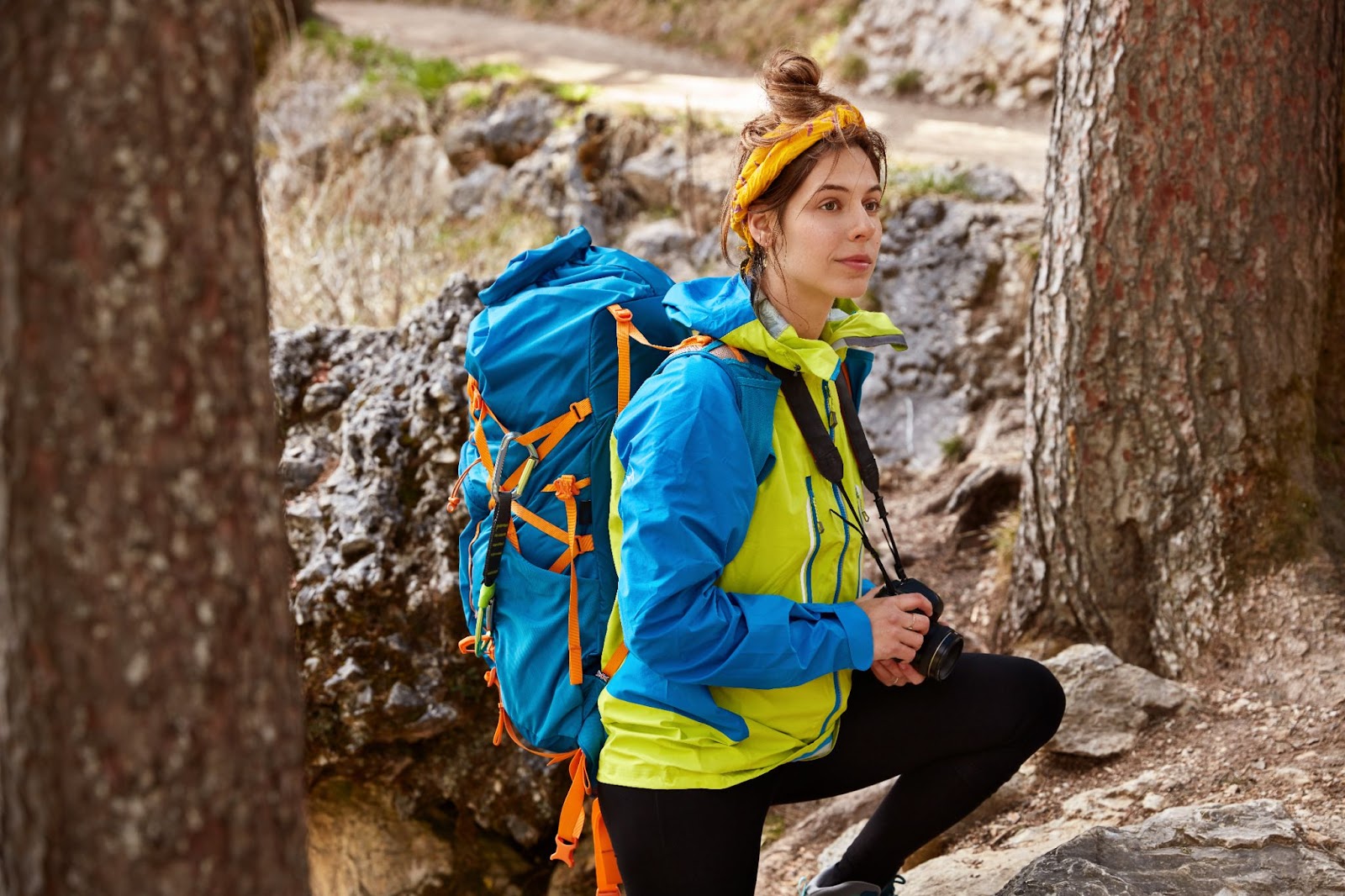
                                  Checklist for Trekking Gear & Equipment for Trekking in Nepal

                                  You should consider packing multi-layers of clothes that are appropriate for the different climatic zones you will traverse across. Also, packing the right set of gears can enhance the overall experience and add more comfort to your journey. This circuit trekking adventure will take you across five climatic zones: tropical, sub-tropical, temperate, sub-alpine, and alpine zones; thus, you pack your backpack to accommodate all these zones.

                                  However, be mindful about making your backpack as light as possible, of courser, without leaving the essentials. Explorer Adventure will provide you with a helpful porter to assist you with your luggage; we will assign one porter to trekkers. The porter will carry about 15 kg of luggage for each trekker; you will have to carry the remaining luggage by yourself. You can check out our following pack list suggestion as a reference to optimize your packing for the trek.

                                  Head and Upper Body

                                  • Sunbrim hat
                                  • Woolen or insulated hat
                                  • Head and neck scarf
                                  • Neck gaiter
                                  • Comfortable base layers (moisture-wicking)
                                  • Lightweight t-shirt (full and half)
                                  • Sweatshirt and sweater
                                  • Warm thermals
                                  • Fleece jacket
                                  • Hooded rain jacket
                                  • Windproof jacket
                                  • Down jacket
                                  • Undergarments (several pairs and different layers)

                                  Lower Body and Feet

                                  • Lightweight cotton pant
                                  • Hiking shorts
                                  • Breathable trousers
                                  • Waterproof/windproof trousers
                                  • Insulated trousers for alpine altitudes
                                  • Comfortable trekking boots
                                  • Sports shoes
                                  • Slipper or sandals
                                  • Waterproof gaiter

                                  Personal Hygiene

                                  • Sunscreen cream
                                  • Bars soap, shampoo and conditioner
                                  • Body lotion and lip care
                                  • Toothbrush and toothpaste
                                  • Small mirror
                                  • Body deodorants
                                  • Nail clipper and disposable razor
                                  • Female hygiene products
                                  • Quicky drying towel
                                  • Hand sanitizer
                                  • Personal medication
                                  • Insect repellent
                                  • Foot powder
                                  • Toilet paper
                                  • Wet wipes and tissue paper

                                  Trekking Gear/Equipment

                                  • Trekking poles
                                  • Sleeping bag or pad
                                  • Portable power bank
                                  • Thermos flask
                                  • Rain cover
                                  • Sunglasses with UV protection
                                  • Headlamp and flashlight
                                  • Guidebook and trail map
                                  • GPS device
                                  • Binoculars
                                  • Duct tape
                                  • Multi-tool knife
                                  • Magazines or books
                                  • Board games
                                  • Journal and pen

                                  Required Permits

                                  During this exciting circuit trek in the second mainstream Himalayan trekking destination, you will trek across the conserved area in the region. Thus, to access this conserved area you will have to get the necessary permit. Similarly, the Nepali authorities have made the TIMS Card mandatory permit for the high altitude treks in the country. This card helps the authorities keep track of your entry points and makes it efficient to take action if search and rescue operations are required.

                                  Necessary Permits for Annapurna Circuit Trek

                                  • Annapurna Conservation Area Project (ACAP) Permit
                                  • Trekker’s Information Management System (TIMS) Card

                                  The cost of the Annapurna Conservation Area Project (ACAP) Permit is around US$ 30, and the TIMS Card costs approximately US$ 17. These trekking permits can be collected at the Nepal Tourism Board Office located in Kathmandu and the Tourism Board’s Tourist Service Centre in Pokhara. However, Explorer Adventure will take care of all the necessary permits and collect them for you to add a seamless experience to your journey.

                                  Safety and Considerations

                                  Your safety and well-being is the top priority of the Explorer Adventure; during your Himalayan trek, we will take care of every minor detail to ensure you can enjoy a safe and enjoyable trek. An experienced and licensed guide in this circuit route will lead your trekking team, and we will also provide assistant guides depending on the size of the team to ensure that the guides can be on the lookout for the well-being of every trekker.

                                  On top of being licensed and well-versed in the circuit route, our guides have also received high altitude and first-aid training. So, you can rely on them to act efficiently and tactfully in case of any unforeseen circumstances. Your guide will monitor your physical condition throughout each day of the trek and oversee your comfort level. They will also coordinate with the head office and arrange an evacuation if it is necessary without taking risks on the health of our esteemed guests.

                                  You may also like:

                                  Is This Trek Right For Me?

                                  Exploring the naturally enticing and culturally diverse trails of the Annapurna region is a lifelong dream of many. This thrilling circumnavigating adventure of the blessed Annapurna is not just a Himalayan but a life-changing journey as well. If you are concerned about whether this is the right trek for you or not after considering the demanding factors of the trip, then you don’t have to worry about a thing. Although this circuit trekking is a high-altitude trekking adventure in the central Himalayas, and you have to walk over one of the highest Himalayan passes in the country, Throrong La Pass (5,416 meters), the journey itself isn’t strenuous.

                                  You will take your time to slowly navigate the rugged trails of the Himalayas and acclimatize properly before heading toward the high-altitude points of the trek. If you are physically prepared, you will be able to easily overcome the major demanding portions of this trip. Also, doing this trek in the high season, like spring and autumn, will ensure dry trekking trails for a comfortable walking experience. So, in overall, it will the difficulty level of your trip will depend on how well you have planned and prepared for the journey.

                                  Otherwise, with a basic fitness level and good health conditions, this thrilling journey isn’t that big of a challenge. The trekking success rate on the Annapurna Circuit Trek route is around 98% to 100%; the mild challenges and the surreal experience are the factors that make this journey memorable. Even children as young as 8 years old have successfully completed this iconic Himalayan trekking route.

                                  Annapurna Circuit Trekking FAQs

                                  • The food and accommodation used to be extremely simple. However, at present, the food and accommodation are rather good due to the flow of trekkers. There are many nice lodges for accommodation and a variety of food on the menu. The rooms are simple and clean and have large dining halls where food is served in a lively home environment. 

                                    The rooms with attached bathrooms are few in number because of the location and cold weather. This is because the plumbing can get frozen, especially around the higher areas. There is only basic accommodation and food around Yak-Kharka and around the high camp of Thorang-la. 

                                    Food is served per A La Carte for larger groups of more than four people. We recommend you to have set meals like Dal Bhat to save energy and fuel. It is also a perfect way to follow the rules of responsible tourism or eco-trekking.

                                  • Almost every village and lodge has facilities to charge your electric items and wifi. They are generally run by local hydropower or solar power. That said, you will need to pay extra per hour for your items. For this, you should coordinate with the guide or the landlord regarding the price. This includes charges for hot showers, internet, wifi, and telephone collections. 

                                    The internet and phone connection is interrupted and slow. Therefore, we recommend you buy local SIM and Internet data for your cell phone in Kathmandu if you want to use the internet.

                                  • There are a few hospitals for proper health care, and it is located at Chame, Jomsom, and Pokhara. The large villages and towns have small health posts. However, they may lack proper healthcare and doctors. On treks, we carry a complete medical box with medications for general illnesses and wounds.

                                  • We can get safe drinking water at every overnight lodge. We can also find safe drinking water in some areas en route with water drinking stations. ACAP provides the service at reasonable prices. 

                                    Buying bottled water can be expensive in higher locations. T Try to avoid buying plastic bottles. Note that purifying tablets only work 30% to 40% in Himalayan waters as they contain heavy minerals.

                                  • The trekking starts with a moderate walk from1,500 m to slowly getting acclimatized. The walk is relatively easy, and you can walk at a normal pace.

                                    The only tough part of the climb is the Thorang-La pass at 5,416 m, and this only lasts for a few hours. 

                                    Therefore, when compared to other Himalayan high destinations, the Annapurna Trekking Circuit is relatively easy. 

                                  Client Reviews
                                  • It was a trip of a lifetime!

                                    Thank you very much Bam, Amrit and Daki Pa to make it possible! I dreamed to walk this track for almost 5 years after the last large avalanche killed many tourists. 
                                    How I felt throughout the walk? It was great, I felt looked after, cared and listened, even on the way back home when Amrit formal duties of care finished, he still assisted me with what he could. The walk up and down the hills is not always easy for your knees..Amrit has the first aid on him to assist if any signed of issues felt. Daki Pa has less communication skills but his care and warm personality was making for it. He is young, but fit for the job! Amaizing landscapes and people working outside of their homes shown a glimpse of a different world. Amrit was there to explain the nuances of their customs, believes and traditions. Our minds were totally busy watching out for the wonders of the way, what distracted us from the hardship of the walk itself. After the 3800 m heights we both felt the signs of heights sleekness...again Amrit was there with helping hand. He had the pills, which removed unpleasant simptoms. 
                                    I cannot thank you guys enough for the joy I had throughout my 2 weeks adventure. For those of you who is still thinking, Explore Adventure is a team who you can trust in the mounting. They won’t run away from you, will listen and will care!

                                    Olia. Auckland.
                                    Olia. Auckland.New Zealand,November 28, 2019
                                    logo
                                  • Annapurna Circuit Trek

                                    We just completed the Annapurna Circuit Trek with Amrit and Dahlkeepa . We had a fantastic time. The trip was very well organised and we were very well looked after throughout. The scenery was amazing and the views of the Annapurna range were simply stunning. Amrit and Dahlkeepa were friendly, relaxed and professional and made it a trip we will never forget. We would Thoroughly recommend this company . 
                                    Thank You Amrit and Dahlkeepa 
                                    Lisa and Richard

                                    Lisa
                                    LisaUnited Kingdom,November 23, 2019
                                    logo
                                  SimilarTrips