Manaslu and Annapurna Circuit Map - Outline Itinerary Route

Day 01: Kathmandu arrival and hotel transfer
Day 02: Sightseeing day in Kathmandu and trek preparation
Day 03: Drive from Kathmandu to Machha Khola and trek to Khola Besi
Day 04: Trekking from Khola Besi to Jagat
Day 05: Jagat to Dyang
Day 06: Trek from Dyang to Namrung
Day 07: Trekking to Lo-Gaon
Day 08: Trek from lo-Gaon to Sama-Gaon
Day 09: Acclimatization day at Sama-Gaon and Short hike
Day 10: Trekking from Sama-Gaon to Samdo
Day 11: Samdo to Dharmasala
Day 12: Trekking from Dharmasala to Bhimthang via Larke-La Pass
Day 13: Trek to Gho from Bhimthang
Day 14: Gho to Timang
Day 15: Timang to Pisang tek via Chame
Day 16: Trekking from Pisang to Manang
Day 17: Acclimatization day at Manang
Day 18: Manang to Yak Kharka trek
Day 19: Trek to Thorang-La High Camp/Phedi from Yak Kharka
Day 20: Trekking to Muktinath via Thorang La Pass
Day 21: Drive down to Tatopani from Muktinath via Jomsom
Day 22: Tatopani to Ghorepani trek
Day 23: Morning hike to Poon Hill, trek down to Ulleri and drive to Pokhara
Day 24: Drive or fly back to Kathmandu from Pokhara
Day 25: International departure day
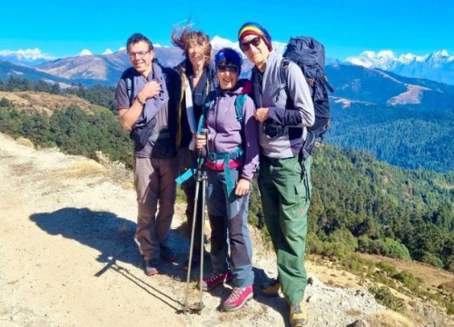
Manaslu and Annapurna Circuit Trek Overview

This unique blend of both major mainstream trekking destinations in the northern and north-central sections of the Nepali Himalayas is an unforgettable experience. Your Manaslu and Annapurna Circuit Map on the initial part follows the rugged route across the isolated sections of the Manaslu region before joining the world-renowned mainstream route of the Annapurna circuit. Your duo circuit trekking adventure in the Nepali Himalayas starts with an exciting drive from Kathmandu to Machha Khola, followed by a trek to Khola Besi. You will then move along the gradually ascending route across the beautiful settlements of the Manaslu region, like Jagat, Dyang, Namrung, Lo-Gaon, and Sama Gaon, where you will enjoy your first acclimatization day.
Then, you will continue trekking toward the high elevation points of the Manaslu Circuit Trek, like Samdo and Dharmasala/Larke Phedi, before crossing the Larke-La Pass to descend down to Gho. After descending down to Timang, you will join the mainstream route of the Annapurna Circuit Trek and make you ascend toward Pisang via Chame Town. You will then trek to Manang, which will be the second acclimatization day in your duo circuit trekking adventure. From Manang, you will ascend to the high-altitude points of the Annapurna region across Yak Kharka and Thorang-La Phedi before climbing over the Thorang-La Pass to descend to Muktinath.
Generally, the trek down to Muktinath would complete the incredible Annapurna Circuit route, and you would make your descent down to Pokhara. However, in this duo-circuit exploration, you will also do a side excursion to one of the most popular viewpoints of the Annapurna region. From Muktinath, you will drive down to Tatopani (a natural hot spring) via Jomsom Bazaar and trek to Ghorepani. You will then do a morning hike to Poon Hill to enjoy the breathtaking Himalayan panorama and trek down to Ulleri before driving down to Pokhara. The next morning, you will drive or fly back to Kathmandu after doing some sightseeing around Pokhara, the city of lakes.
Manaslu and Annapurna Circuit Map - Daily Activity and Detailed Route

Day 01: Kathmandu arrival and hotel transfer
Kathmandu Elevation: 1,400 meters/ 4,593 feet
Your international flight brings you to Tribhuvan Internationa Aiport (TIA), where you will be received by our staff. A swift hotel transfer will follow; take your time to rest and do sightseeing nearby if you have time.
Day 02: Sightseeing day in Kathmandu and trek preparation
Kathmandu Elevation: 1,400 meters/ 4,593 feet
You will explore some of the prominent UNESCO World Heritage Sites located in Kathmandu. On this day, we will collect all the necessary permits, and you can also complete your shopping. Trek briefing by your guide and insider tips on upcoming adventures.
Day 03: Drive from Kathmandu to Machha Khola and trek to Khola Besi
Kathmandu Elevation: 1,400 meters/ 4,593 feet
Maccha Khola Elevation: 900 meters/ 2,952 feet
Khola Besi Elevation: 1,070 meters/ 3,510 feet
Elevation Gain: 330 meters/ 1,082 feet
Driving along the Prithvi Highway, you will move along the banks of the Trishuli River across traditional settlements, terraced farms, and whitewater rivers. After crossing the Dhading Bensi, you will then drive past Arughat and Soti Khola to arrive at Machha Khola. Then trekking in the Budhi Gandaki Valley, you will trek to Khorla Besi, passing the Lapu Besi.
Driving Duration: 6 hours
Trek Duration: 2 hours
Day 04: Trekking from Khola Besi to Jagat
Khola Besi Elevation: 1,070 meters/ 3,510 feet
Jagat Elevation: 1,340 meters/ 4,396 feet
Elevation Gain: 270 meters/ 885 feet
Trek continues from Khola Besi alongside the banks of the Budhi Gandaki River; you will first trek past the Khorsani Village and then across Labishe Village to reach the Jagat Village.
Trek Duration: 6 hours
Day 05: Jagat to Dyang
Jagat Elevation: 1,340 meters/ 4,396 feet
Dyang Elevation: 2,130 meters/ 6,988 feet
Elevation Gain: 790 meters/ 2,591 feet
Descending the Dudh Pokhari Khola, you will cross a suspension bridge and head toward Sirdibas Village. You will then make your ascend to Ghatte Khola and reach Philim after walking past the Chisapani Village you will also cross the beautiful settlements at Nyak and Pewa before reaching Deng Village.
Trek Duration: 6 hours
Day 06: Trek from Dyang to Namrung

Dyang Elevation: 2,130 meters/ 6,988 feet
Namrung Elevation: 2,618 meters/ 8,589 feet
Elevation Gain: 488 meters/ 1,601 feet
You will continue trekking alongside the Budhi Gandaki River and gradually climb across Bihi Phedi and Bihi Village. Walking close to the Tibetan border, you will also cross the Rana Bridge and trek past the mani walls, praying flags, and chortens. You will then trek past the Prok Village before reaching the Namrung Village.
Trek Duration: 5 hours
Day 07: Trekking to Lo-Gaon
Namrung Elevation: 2,618 meters/ 8,589 feet
Lo-Gaon Elevation: 3,180 meters/ 10,433 feet
Elevation Gain: 562 meters/ 1,843 feet
From Namrung, you will trek past the Lihi Village and cross the stream nourished by the Lindanda Glacier to reach the Sho Village. Then, passing across the mani walls and chortens, you will reach the Lo-Gaon.
Trek Duration: 5 hours
Day 08: Trek from Lo-Gaon to Sama-Gaon

Lo-Gaon Elevation: 3,180 meters/ 10,433 feet
Sama-Gaon Elevation: 3,530 meters/ 11,581 feet
Elevation Gain: 350 meters/ 1,148 feet
You will walk past the lush forested trails to reach the Shyala Village, and moving past the farms land, you will cross a stream that originates from Punggen Glacier to reach the flat surface of Sama-Gaon, the closest village to Manaslu Base Camp.
Trek Duration: 5 hours
Day 09: Acclimatization day at Sama-Gaon and a short hike
Sama-Gaon Elevation: 3,530 meters/ 11,581 feet
This is the first acclimatization day in your duo circuit trekking adventure, you can do short hikes to Manaslu Base Camp or Biredndra Tal on this day to acclimatize properly.
Day 10: Trekking from Sama-Gaon to Samdo
Sama-Gaon Elevation: 3,530 meters/ 11,581 feet
Samdo Elevation: 3,860 meters/ 12,664 feet
Elevation Gain: 330 meters/ 1,082 feet
Moving further in your ascending route, you will trek on the terraced hill opposite the Budhi Gandaki River bank. You will trek along the pleasant trails through juniper and birch forests to descend to the river before ascending to Samdo Village.
Trek Duration: 5 hours
Day 11: Samdo to Dharmasala
Samdo Elevation: 3,860 meters/ 12,664 feet
Dharmasala Elevation: 4,470 meters/ 14,665 feet
Elevation Gain: 610 meters/ 2,001 feet
You will trek on the barren terrain of the region and across the Larkya Bazaar during the first part. Then, your trek around the Salkha Khola Valley before ascending to Dharmasala, a.k.a Larkya Phedi.
Trek Duration: 4 hours
Day 12: Trekking from Dharmasala to Bhimthang via Larke-La Pass

Dharmasala Elevation: 4,470 meters/ 14,665 feet
Bhimthang Elevation: 3,720 meters/ 12,204 feet
Larke-La Pass Elevation: 5,106 meters/ 16,751 feet
Elevation Gain: 636 meters/ 2,086 feet
It's an exciting day’s trek today; you will climb over the Larke-La Pass to reach Bhimthang. You will navigate the rocky and steep trail of the Pass, enjoying the epic mountain views before descending to the serene pastures of Bhimthang.
Trek Duration: 8 hours
Day 13: Trek to Gho from Bhimthang
Bhimthang Elevation: 3,720 meters/ 12,204 feet
Gho Elevation: 2,560 meters/ 8,398 feet
Elevation Loss: 1,160 meters/ 3,805 feet
Continuing with your descending trail, you will head down to the banks of the Budhi Gandaki River and trek past beautiful rhododendron forests to reach Karche Village. You will then continue trekking toward the Gho Village.
Trek Duration: 4 hours
Day 14: Gho to Timang
Gho Elevation: 2,560 meters/ 8,398 feet
Timang Elevation: 2,100 meters/ 6,889 feet
Elevation Loss: 460 meters/ 1,509 feet
You will continue trekking downhill across small settlements and terraced farms to reach the Tilje Village. You will then continue trekking to Thonje Village before reaching the Timang Village for an overnight stay.
Trek Duration: 6 hours
Day 15: Timang to Pisang tek via Chame
Timang Elevation: 2,100 meters/ 6,889 feet
Pisang Elevation: 3,190 meters/ 10,465 feet
Elevation Gain: 1,090 meters/ 3,576 feet
Today, you will join the mainstream route of the Annapurna Circuit Trek, and you will head toward Pisang crossing the Chame Village. You will walk past pine and rhododendron forests and walk past the Bhratang Village and Dukure Pokhari before reaching Pisang.
Trek Duration: 6 hours
Day 16: Trekking from Pisang to Manang
Pisang Elevation: 3,190 meters/ 10,465 feet
Manang Elevation: 3,540 meters/ 11,614 feet
Elevation Gain: 350 meters/ 1,148 feet
You will ascend on the uphill route across Geru and pass the charming Tibetan settlements heavily influenced by the Buddhist culture. You will also explore the Barge Monastery before reaching Manang.
Trek Duration: 4 hours
Day 17: Acclimatization day at Manang
Manang Elevation: 3,540 meters/ 11,614 feet
This will be the second acclimatization in your extensive Himalayan exploration. On this day, you can hike to Ice Lake (about 16 km away from Manang) and other villages around the region for effective acclimatization.
Day 18: Manang to Yak Kharka trek
Manang Elevation: 3,540 meters/ 11,614 feet
Yak Kharka Elevation: 4,210 meters/ 13,812 feet
Elevation Gain: 670 meters/ 2,198 feet
You will make your ascend to Yak Kharka across the Tenki Village and Gunsan Village. Traversing across the small stream and juniper forests, you will finally arrive at Yak Kharka.
Trek Duration: 4 hours
Day 19: Trek to Thorang-La High Camp/Phedi from Yak Kharka
Yak Kharka Elevation: 4,210 meters/ 13,812 feet
Thorang-La High Camp Elevation: 4,450 meters/ 14,599 feet
Elevation Gain: 240 meters/ 787 feet
From Yak Kharka, you will climb across the ridge and then cross the Marsyangdhi River over a wooden bridge. You will move along the narrow path across the slope to descend to rugged Thorang-La Phedi.
Trek Duration: 4 hours
Day 20: Trekking to Muktinath via Thorang La Pass
Thorang-La High Camp Elevation: 4,450 meters/ 14,599 feet
Muktinath Elevation: 3,800 meters/ 12,467 feet
Thorang La Pass Elevation: 5,416 meters/ 17,769 feet
Elevation Gain: 966 meters/ 3,169 feet
Today, you will climb over the Thorang La Pass across the steep regular route and enjoy the incredible 360° Himalayan panorama from the top. You will then descend to Muktinath temple, a significant religious site among Buddhists and Hindus.
Trek Duration: 6 hours
Day 21: Drive down to Tatopani from Muktinath via Jomsom

Muktinath Elevation: 3,800 meters/ 12,467 feet
Tatopani Elevation: 1,100 meters/ 3,608 feet
Jomsom Elevation: 2,715 meters/ 8,907 feet
Elevation Loss: 2,700 meters/ 8,858 feet
From Muktinath, you will drive down to Tatopani in a convenient vehicle. You will drive past lush forests, terraced farms, and traditional settlements before reaching Tatopani for a warm dip in its natural hot springs.
Drive Duration: 4 hours
Day 22: Tatopani to Ghorepani trek
Tatopani Elevation: 1,100 meters/ 3,608 feet
Ghorepani Elevation: 2,845 meters/ 9,333 feet
Elevation Gain: 1,745 meters/ 5,725 feet
You will trek past scenic rhododendrons and oak forests on this day’s trek. You will also have the opportunity to explore the traditional settlements of Sikha Village and Chitre Village before reaching Ghorepani.
Trek Duration: 6 hours
Day 23: Morning hike to Poon Hill, trek down to Ulleri and drive to Pokhara

Ghorepani Elevation: 2,845 meters/ 9,333 feet
Poon Hill Elevation: 3,210 meters/ 10,531 feet
Ulleri Elevation: 2,100 meters/ 6,889 feet
Pokhara Elevation: 860 meters/ 2,821 feet
Elevation Gain: 365 meters/ 1,197 feet
Today, you will do an early morning hike to Poon Hill to enjoy the breathtaking sunrise view and panoramic views of Annapurna, Dhaulagiri, Machhapuchre, and other surrounding peaks. Then, after breakfast at Ghorepani, you will descend to Ulleri from where you will drive down to Pokhara.
Trek Duration: 7 hours
Day 24: Drive or fly back to Kathmandu from Pokhara
Pokhara Elevation: 860 meters/ 2,821 feet
Kathmandu Elevation: 1,400 meters/ 4,593 feet
Elevation Gain: 540 meters/ 1,771 feet
After exploring Pokhara, on this day, you will either drive or fly back to Kathmandu. Depending on your arrival time at Kathmandu, you can also do some sightseeing explorations around the valley.
Drive Duration: 7 hours
Day 25: International departure day
Kathmandu Elevation: 1,400 meters/ 4,593 feet
Your incredible duo circuit trekking adventure in the Himalayas is complete, today, according to your flight time, we will drop you at TIA. Have a safe journey.
How Difficult is This Trek?
Manaslu and Annapurna Circuit map follows both the mainstream trekking trails of the Annapurna region as well as the rugged and isolated trails of the Manaslu region. As both of these popular trekking routes have been labeled as moderate trekking experiences, this duo circuit trekking adventure in the Himalayas also falls overall in the moderate category. However, this is an extensive adventure that explores two of the most popular mainstream circuit trekking routes in the Nepali Himalayas; thus, it is a physically demanding journey. Depending on the route followed by your Manaslu and Annapurna Circuit map and overall itinerary plans, this lengthy Himalayan journey can last somewhere between 23 to 28 days.
During the trekking part, you will walk about 6 to 7 hours on average across the remote and isolated trails of the Himalayas that gradually ascend to the high elevation points. Similarly, in this duo circuit trekking adventure of the northern Himalayas, you will have to cross two of the major Himalayan passes: Larke-La Pass (5,106 meters) and Thorang La Pass (5,416 meters). Although you will acclimatize properly before taking on these passes, the highest elevation points of both circuit trekking routes, it can still be exhausting if you are not well prepared. So, overall, how difficult you will find this duo circuit excursion will depend on how well you have physically prepared for the trip.
Get Insights On:
Best Time for Manaslu and Annapurna Circuit Trek

Spring (March to May) and autumn (September to November) are undoubtedly the most suitable time frame to make the most out of this duo circuit trekking adventure. You will have an easier time navigating the rugged Himalayan trails of Manaslu and Annapurna Circuit map during these high seasons, and the stable climate will add more comfort to your journey. Generally, the spring season is considered the high time of mother nature, and the lush landscapes make your exploration even more enthralling.
Similarly, the autumn season is famous for its most stable climatic conditions, dry trekking trails, and clear days that unveil the epic Himalayan vistas till the end of the horizon. The temperatures of both the Annapurna and Manaslu regions during the spring season average around 5°C to 23°C during the daytime and can drop up to -8°C at high altitudes during the night. Similarly, during the autumn season, the daytime temperature averages around 4°C to 18°C, and it can drop to -5°C at night.